SoCalGas to use LiDAR to reduce Methane
- September 7, 2021
- William Payne
The Southern California Gas Company (SoCalGas), the largest gas distribution utility in the United States, is using Gas Mapping LiDAR from Bridger Photonics to detect, pinpoint, and quantify methane emissions throughout its distribution area. Methane, a primary constituent in natural gas, is 84 times more potent than carbon dioxide as a greenhouse gas on short time scales.
SoCalGas currently serves over 21 million consumers with nearly 5.9 million metres of natural gas pipeline in more than 500 communities.
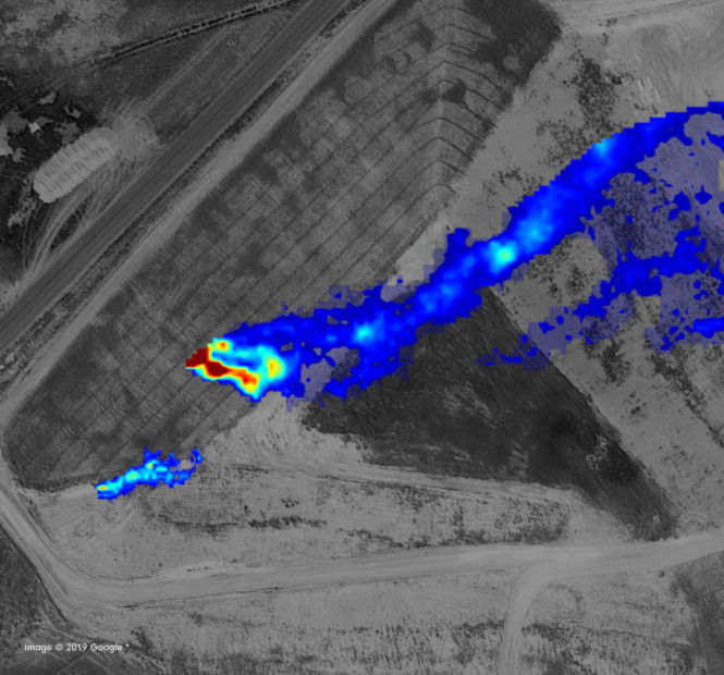
SoCalGas monitors its service area each year with foot patrols. However the company has decided to use Gas Mapping LiDAR to improve safety and reduce emissions. Helicopters equipped with LiDAR sensors will fly over SoCalGas’s distribution area to scan for methane emissions. After each day’s scan, Bridger will provide SoCalGas with a digital map that shows gas plume images, pinpoints the leak source with GPS coordinates and quantifies the detected methane emissions. SoCalGas will use this information to dispatch appropriate crews straight to the emissions source to resolve the problem.
“Using this new technology is another way we are working to meet our commitment to reach net-zero emissions by 2045,” said Gina Orozco, vice president of gas engineering and system integrity at SoCalGas. “This technology provides us with a critical early detection system that can help us mitigate leaks more quickly, while we also move to use more lower and zero-carbon fuels to increasingly decarbonise our pipeline system.”